


After hitting a high temperature of 91 degrees yesterday (Monday), a cold frontal boundary moved into the area in the late afternoon bringing with it severe weather, including significant amounts of rainfall and high winds. Sioux County Deputy Sheriff and Emergency Management Coordinator, Nate Huizenga, spoke with us this morning about the events last night.
Because of the heavy rain, several roads needed to be closed.
Following the first wave of rain was some areas of high wind, including some straight-line winds that blew a hog confinement building onto Highway 60.
Huizenga thinks the damage was localized and not a tornado.
Huizenga thanked the fire departments of Hospers, Boyden, and Granville along with the DOT for quick clean-up of the debris that allowed highway 60 to reopen yet last evening.
Other Sheriff’s alerts included: trees down over roadway, railroad cross-arms malfunctioning, and power lines down across the roadway is area around Sioux County.
The Deputy said many reporting rain gauges across the county showed rainfall amounts of 3 to over 4 inches, with higher amounts in the northeastern portion of the county. At Sioux County Radio on the south side of Sioux Center, we had 2.26 inches as of 7 am this morning, with an additional 0.24 inches through noon.
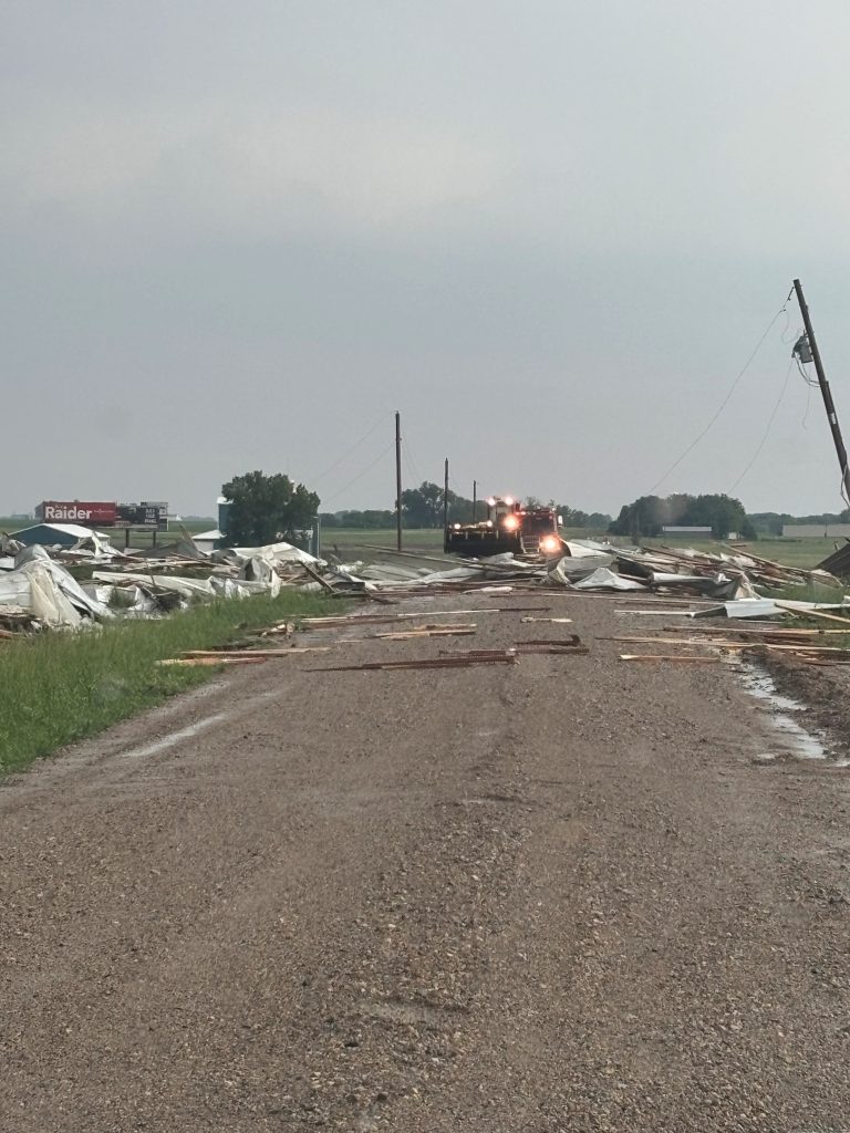
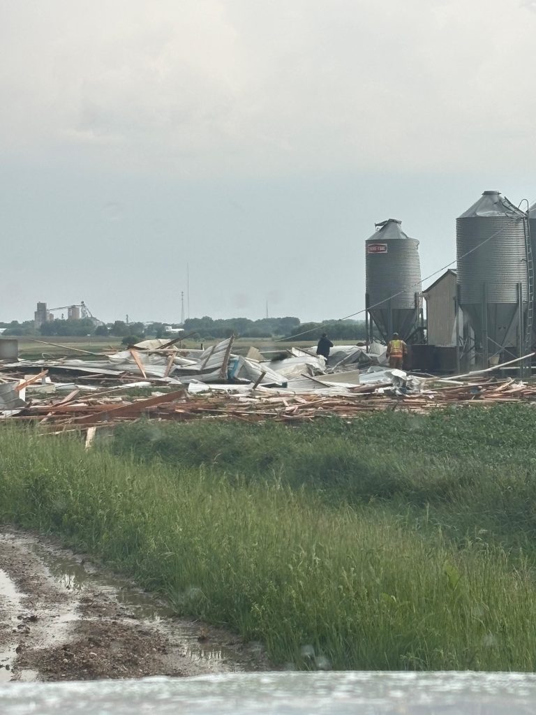
(Photos of damage near Hospers courtesy of Sioux County Sheriff’s Office)